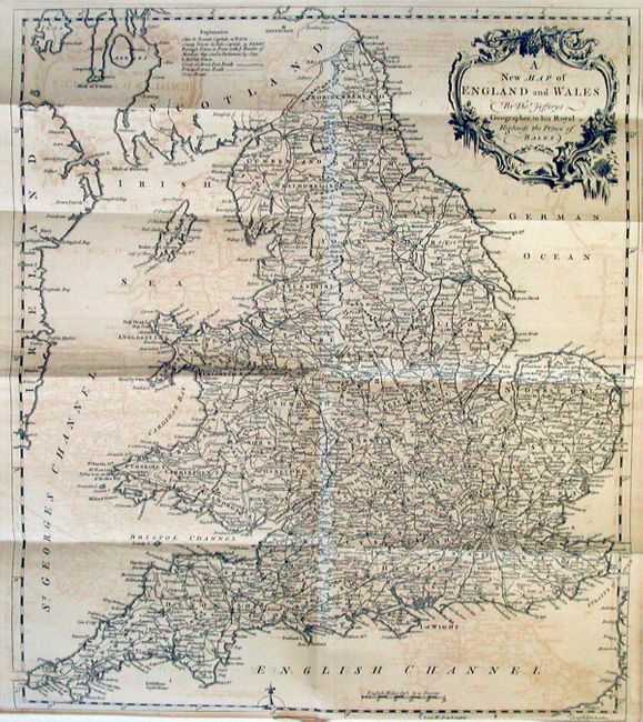
Title:
“A New Map of England and Wales By Thos. Jefferys Geographer to his royal Highness the Prince of Wales”
Map Maker:
Thomas Jefferys
Well engraved map with much detail throughout the ... (full text available to subscribers)
| Item Detail |
| |
| |
MapMaker: |
Thomas Jefferys
|
|
| |
| |
Subject: |
England & Wales |
|
| |
Period/Size: |
1757 / 17.0" x 14.6" (43.2 x 37.1 cm)
|
|
| |
Color: |
Black & White
|
|
| |
Condition: |
(B) Crisp impression on hand-laid paper. Offsetting noticeable in blank areas. Tiny fold intersection split. (condition help) |
|
| |
Source: |
Gentleman's Magazine |
|
| |
References: |
Jolly GENT-113. |
|
| |
|
|
| Sales Information |
| |
| |
Price: |
|
|
| |
| |
Offered by: |
Old World Auctions |
|
| |
Catalog: |
Auction No. 114 - Antique Maps, Charts, Atlases & Globes (567) |
|
| |
Lot/Item #: |
368 |
|
| |
| |
Date: |
03/2006
|
|
| |
| |
|
Antique Maps - Valuation and Pricing, Descriptions, Resources |
|
Home |
Information |
Search |
Register |
Contact Us |
Site Map
Americana Exchange, Inc. © 1999 - 2024 Americana Exchange, Inc.. All rights reserved.
OldMaps.com, the OldMaps.com logo and
AMPR are service marks or registered service marks of Americana Exchange, Inc..
|