| Item Detail |
| |
| |
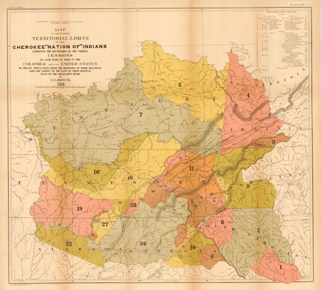
MapMaker: |
Charles C. Royce
|
|
| |
| |
Subject: |
United States - Central |
|
| |
Period/Size: |
1884 / unknown
|
|
| |
Color: |
Colored
|
|
| |
Condition: |
(A) Both issued folding, and now pressed and backed with archival tissue. A hint of toning along some folds, tiny loss at one fold intersection in the former, and light offsetting on the second map, still very good. (condition help) |
|
| |
Source: |
5th Annual Report Bureau of Ethnology |
|
| |
References: |
|
|
| |
|
|
| Sales Information |
| |
| |
Price: |
|
|
| |
| |
Offered by: |
Old World Auctions |
|
| |
Catalog: |
Auction No. 114 - Antique Maps, Charts, Atlases & Globes (567) |
|
| |
Lot/Item #: |
178 |
|
| |
| |
Date: |
03/2006
|
|
| |
| |
|