Title:
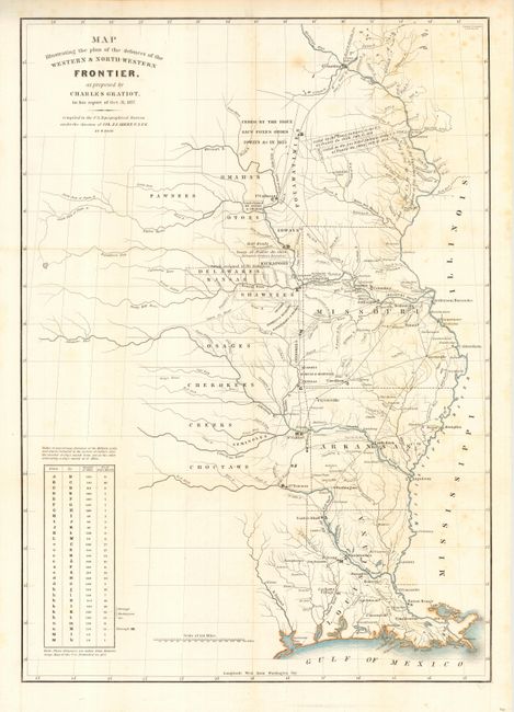
“Map Illustrating the plan of the defences of the Western & North- Western Frontier, as proposed by Charles Gratiot, in his report of Oct. 31, 1837”
Map Maker:
Charles Gratiot
This map is from the series of maps that illustrat... (full text available to subscribers)
| Item Detail |
| |
| |
MapMaker: |
Charles Gratiot
|
|
| |
| |
Subject: |
United States - Central |
|
| |
Period/Size: |
1837 / 21.3" x 15.0" (54.1 x 38.1 cm)
|
|
| |
Color: |
Colored
|
|
| |
Condition: |
(B) Issued folding, now pressed and backed with archival tissue. Very fine, crisp impression. Some light scattered foxing in right portion of map. Nearly invisible tear in title area repaired, else very good. (condition help) |
|
| |
Source: |
HR Doc 311 25th Cong 2nd Sess. |
|
| |
References: |
Wheat [TMW] #426. |
|
| |
|
|
| Sales Information |
| |
| |
Price: |
|
|
| |
| |
Offered by: |
Old World Auctions |
|
| |
Catalog: |
Auction No. 114 - Antique Maps, Charts, Atlases & Globes (567) |
|
| |
Lot/Item #: |
172 |
|
| |
| |
Date: |
03/2006
|
|
| |
| |
|
Antique Maps - Valuation and Pricing, Descriptions, Resources |
|
Home |
Information |
Search |
Register |
Contact Us |
Site Map
Americana Exchange, Inc. © 1999 - 2024 Americana Exchange, Inc.. All rights reserved.
OldMaps.com, the OldMaps.com logo and
AMPR are service marks or registered service marks of Americana Exchange, Inc..
|