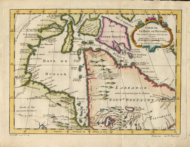
Title:
“Carte de la Baye de Hudson”
Map Maker:
Jacques Nicolas Bellin
A handsome chart of Hudson Bay and Labrador depict... (full text available to subscribers)
| Item Detail |
| |
| |
MapMaker: |
Jacques Nicolas Bellin
|
|
| |
| |
Subject: |
Canada |
|
| |
Period/Size: |
1758 / 8.5" x 11.5" (21.6 x 29.3 cm)
|
|
| |
Color: |
Colored
|
|
| |
Condition: |
(A) Very nice impression and coloring. Hand laid paper with full margins and watermark. Paper hinge remnant at sides. Paper edges appear to be deckled. A few marginal spots. (condition help) |
|
| |
Source: |
Prevost's Histoire Generale des Voyages |
|
| |
References: |
Kershaw #318. |
|
| |
|
|
| Sales Information |
| |
| |
Price: |
|
|
| |
| |
Offered by: |
Old World Auctions |
|
| |
Catalog: |
Auction No. 114 - Antique Maps, Charts, Atlases & Globes (567) |
|
| |
Lot/Item #: |
109 |
|
| |
| |
Date: |
03/2006
|
|
| |
| |
|
Antique Maps - Valuation and Pricing, Descriptions, Resources |
|
Home |
Information |
Search |
Register |
Contact Us |
Site Map
Americana Exchange, Inc. © 1999 - 2024 Americana Exchange, Inc.. All rights reserved.
OldMaps.com, the OldMaps.com logo and
AMPR are service marks or registered service marks of Americana Exchange, Inc..
|