Title:
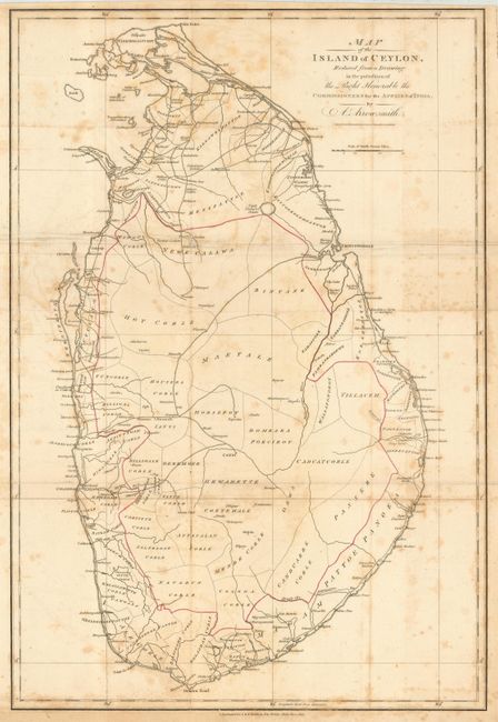
“Map of the Island of Ceylon, Reduced from a Drawing in the possession of the Right Honorable the Commissioners for the Affairs of India”
Map Maker:
Aaron Arrowsmith, Sr.
Large-scale map of Ceylon showing political divisi... (full text available to subscribers)
| Item Detail |
| |
| |
MapMaker: |
Aaron Arrowsmith, Sr.
|
|
| |
| |
Subject: |
Sri Lanka |
|
| |
Period/Size: |
1803 / 21.0" x 14.2" (53.4 x 36.1 cm)
|
|
| |
Color: |
Colored
|
|
| |
Condition: |
(B) Issued folding, now backed with archival tissue and pressed. Binding trim at bottom affecting the first part of publisher's credit line. Foxed and one area of roughness at fold intersection. (condition help) |
|
| |
Source: |
|
|
| |
References: |
|
|
| |
|
|
| Sales Information |
| |
| |
Price: |
|
|
| |
| |
Offered by: |
Old World Auctions |
|
| |
Catalog: |
Auction No. 115 - Antique Maps, Charts, Atlases & Globes (568) |
|
| |
Lot/Item #: |
705 |
|
| |
| |
Date: |
06/2006
|
|
| |
| |
|
Antique Maps - Valuation and Pricing, Descriptions, Resources |
|
Home |
Information |
Search |
Register |
Contact Us |
Site Map
Americana Exchange, Inc. © 1999 - 2024 Americana Exchange, Inc.. All rights reserved.
OldMaps.com, the OldMaps.com logo and
AMPR are service marks or registered service marks of Americana Exchange, Inc..
|