|
|
||
Title:
“Map of the Country Embraced in the Preliminary Survey and Examination of the Peninsula of Florida with a View to the Construction of a Ship Canal from the St. Mary's River to the Gulf of Mexico.”
Map Maker:
U.S. Corps of Engineers
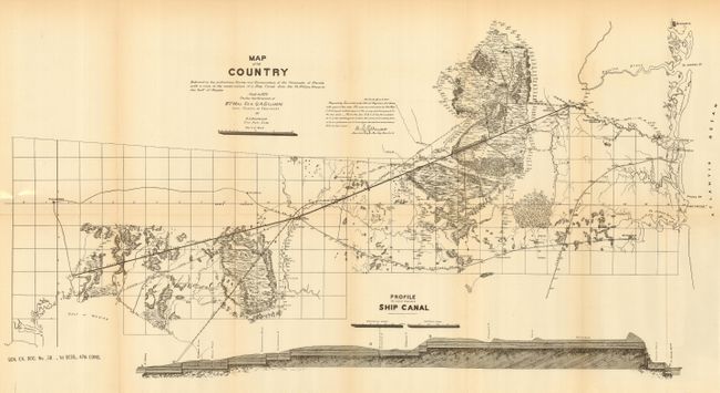
Detailed lithographed map made in 1879 under the ... (full text available to subscribers)
|
|
|||||||||||||||||||||||||||||||||||||||||||||||||||||||||||||||||||||||||||||||||||||||||
Antique Maps - Valuation and Pricing, Descriptions, Resources | ||||||||||||||||||||||||||||||||||||||||||||||||||||||||||||||||||||||||||||||||||||||||||
|
Home |
Information |
Search |
Register |
Contact Us |
Site Map
Americana Exchange, Inc. © 1999 - 2024 Americana Exchange, Inc.. All rights reserved.
OldMaps.com, the OldMaps.com logo and |