Title:
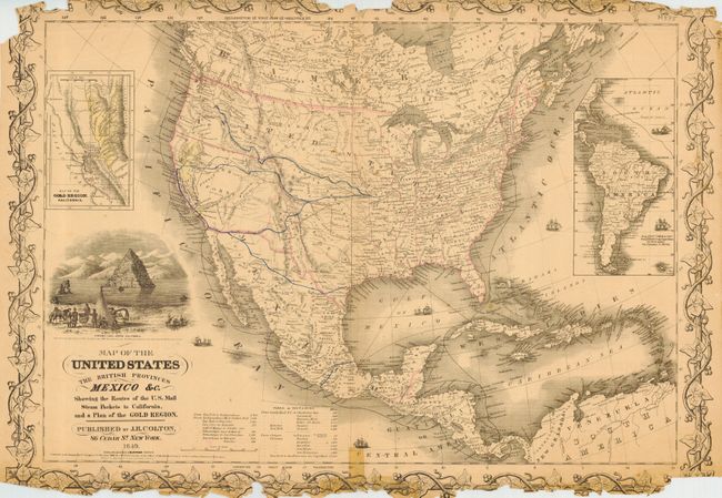
“Map of the United States The British Provinces Mexico &c. Showing the Routes of the U. S. Mail Steam Packets to California, and a Plan of the Gold Region.”
Map Maker:
Joseph Hutchins Colton
An important map that was one of the most up-to-da... (full text available to subscribers)
| Item Detail |
| |
| |
MapMaker: |
Joseph Hutchins Colton
|
|
| |
| |
Subject: |
North America |
|
| |
Period/Size: |
1849 / 18.0" x 24.5" (45.8 x 62.3 cm)
|
|
| |
Color: |
Colored
|
|
| |
Condition: |
(D) Border damaged with extensive loss at top and bottom. Couple spots in map. (condition help) |
|
| |
Source: |
|
|
| |
References: |
Wheat (Gold) #70; Streeter #2534; Wheat (TMW) #591 |
|
| |
|
|
| Sales Information |
| |
| |
Price: |
|
|
| |
| |
Offered by: |
Old World Auctions |
|
| |
Catalog: |
Auction No. 115 - Antique Maps, Charts, Atlases & Globes (568) |
|
| |
Lot/Item #: |
107 |
|
| |
| |
Date: |
06/2006
|
|
| |
| |
|
Antique Maps - Valuation and Pricing, Descriptions, Resources |
|
Home |
Information |
Search |
Register |
Contact Us |
Site Map
Americana Exchange, Inc. © 1999 - 2024 Americana Exchange, Inc.. All rights reserved.
OldMaps.com, the OldMaps.com logo and
AMPR are service marks or registered service marks of Americana Exchange, Inc..
|