Title:
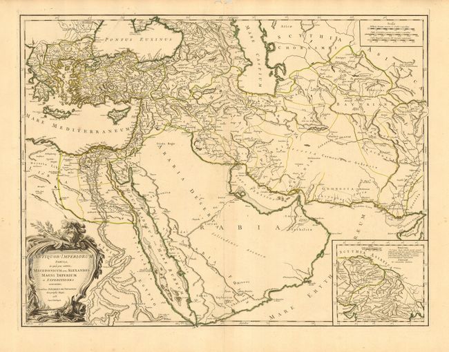
“Antiquor? Imperiorum Tabula, in qua prae coeteris, Macedonicum seu Alexandri Magni Imperium et expeditiones exarantur”
Map Maker:
Didier Robert de Vaugondy
First state of this large map is centered on Arabi... (full text available to subscribers)
| Item Detail |
| |
| |
MapMaker: |
Didier Robert de Vaugondy
|
|
| |
| |
Subject: |
Near and Middle East |
|
| |
Period/Size: |
1753 / 18.5" x 24.5" (47.0 x 62.3 cm)
|
|
| |
Color: |
Colored
|
|
| |
Condition: |
(A) Fine impression with original outline coloring and very wide margins. Hint of centerfold toning, overall very good. Some worm tracks in blank margins. (condition help) |
|
| |
Source: |
Atlas Universel |
|
| |
References: |
Pedley #382. |
|
| |
|
|
| Sales Information |
| |
| |
Price: |
|
|
| |
| |
Offered by: |
Old World Auctions |
|
| |
Catalog: |
Auction No. 115 - Antique Maps, Charts, Atlases & Globes (568) |
|
| |
Lot/Item #: |
651 |
|
| |
| |
Date: |
06/2006
|
|
| |
| |
|
Antique Maps - Valuation and Pricing, Descriptions, Resources |
|
Home |
Information |
Search |
Register |
Contact Us |
Site Map
Americana Exchange, Inc. © 1999 - 2024 Americana Exchange, Inc.. All rights reserved.
OldMaps.com, the OldMaps.com logo and
AMPR are service marks or registered service marks of Americana Exchange, Inc..
|