| Item Detail |
| |
| |
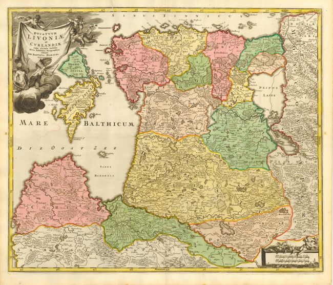
MapMaker: |
Johann Baptist Homann
|
|
| |
| |
Subject: |
Baltic |
|
| |
Period/Size: |
1716 / 19.0" x 22.5" (48.3 x 57.2 cm)
|
|
| |
Color: |
Colored
|
|
| |
Condition: |
(A) Fine impression and original coloring on thick hand laid paper with original margins and large watermark. One small area of color offsetting and short printers crease enters border at top left, else fine. (condition help) |
|
| |
Source: |
Grosser Atlas |
|
| |
References: |
|
|
| |
|
|
| Sales Information |
| |
| |
Price: |
|
|
| |
| |
Offered by: |
Old World Auctions |
|
| |
Catalog: |
Auction No. 115 - Antique Maps, Charts, Atlases & Globes (568) |
|
| |
Lot/Item #: |
406 |
|
| |
| |
Date: |
06/2006
|
|
| |
| |
|