Title:
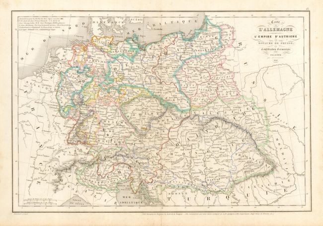
“Carte de l' Allemagne comprenant l' Empire d' Autriche, le Rayaume de Prusse, la Conféderation Germanique et la Pologne”
Map Maker:
Charles Francois Delamarche
Finely engraved map of the Austrian Empire, includ... (full text available to subscribers)
| Item Detail |
| |
| |
MapMaker: |
Charles Francois Delamarche
|
|
| |
| |
Subject: |
Europe - Central |
|
| |
Period/Size: |
1846 / 11.5" x 17.0" (29.3 x 43.2 cm)
|
|
| |
Color: |
Colored
|
|
| |
Condition: |
(A) Fine engraved line and delicate original coloring. (condition help) |
|
| |
Source: |
|
|
| |
References: |
|
|
| |
|
|
| Sales Information |
| |
| |
Price: |
|
|
| |
| |
Offered by: |
Old World Auctions |
|
| |
Catalog: |
Auction No. 115 - Antique Maps, Charts, Atlases & Globes (568) |
|
| |
Lot/Item #: |
479 |
|
| |
| |
Date: |
06/2006
|
|
| |
| |
|
Antique Maps - Valuation and Pricing, Descriptions, Resources |
|
Home |
Information |
Search |
Register |
Contact Us |
Site Map
Americana Exchange, Inc. © 1999 - 2024 Americana Exchange, Inc.. All rights reserved.
OldMaps.com, the OldMaps.com logo and
AMPR are service marks or registered service marks of Americana Exchange, Inc..
|