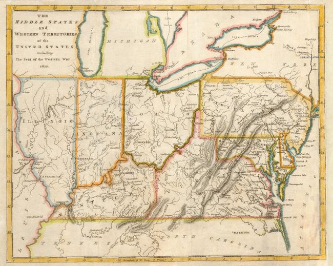
Title:
“The Middle States and Western Territories of the United States including the Seat of the Western War”
Map Maker:
Richard Brookes
This little map has several interesting errors res... (full text available to subscribers)
| Item Detail |
| |
| |
MapMaker: |
Richard Brookes
|
|
| |
| |
Subject: |
United States - Mid-Atlantic and Central |
|
| |
Period/Size: |
1812 / 7.8" x 9.8" (19.9 x 24.9 cm)
|
|
| |
Color: |
Colored
|
|
| |
Condition: |
(B) Issued folding now pressed. Some overall surface soil. Repair of a 4" tear in center of map. Remargined at right with part of bottom right corner replaced with facsimile of border. (condition help) |
|
| |
Source: |
Brookes General Gazeteer Improved |
|
| |
References: |
|
|
| |
|
|
| Sales Information |
| |
| |
Price: |
|
|
| |
| |
Offered by: |
Old World Auctions |
|
| |
Catalog: |
Auction No. 115 - Antique Maps, Charts, Atlases & Globes (568) |
|
| |
Lot/Item #: |
176 |
|
| |
| |
Date: |
06/2006
|
|
| |
| |
|
Antique Maps - Valuation and Pricing, Descriptions, Resources |
|
Home |
Information |
Search |
Register |
Contact Us |
Site Map
Americana Exchange, Inc. © 1999 - 2024 Americana Exchange, Inc.. All rights reserved.
OldMaps.com, the OldMaps.com logo and
AMPR are service marks or registered service marks of Americana Exchange, Inc..
|