Title:
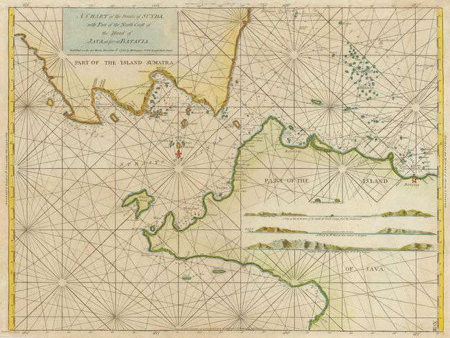
“A Chart of the Straits of Sunda with Part of the North Coast of the Island of Java as far as Batavia”
Map Maker:
William Herbert
This is a very scarce sea chart of the strait betw... (full text available to subscribers)
| Item Detail |
| |
| |
MapMaker: |
William Herbert
|
|
| |
| |
Subject: |
East Indies - Indonesia |
|
| |
Period/Size: |
1780 / 17.5" x 23.5" (44.5 x 59.7 cm)
|
|
| |
Color: |
Colored
|
|
| |
Condition: |
(B) Mostly very good with a bit of faint foxing and a slight weak impression affecting only the longitude scale at top. (condition help) |
|
| |
Source: |
|
|
| |
References: |
|
|
| |
|
|
| Sales Information |
| |
| |
Price: |
|
|
| |
| |
Offered by: |
Old World Auctions |
|
| |
Catalog: |
Auction No. 115 - Antique Maps, Charts, Atlases & Globes (568) |
|
| |
Lot/Item #: |
718 |
|
| |
| |
Date: |
06/2006
|
|
| |
| |
|
Antique Maps - Valuation and Pricing, Descriptions, Resources |
|
Home |
Information |
Search |
Register |
Contact Us |
Site Map
Americana Exchange, Inc. © 1999 - 2024 Americana Exchange, Inc.. All rights reserved.
OldMaps.com, the OldMaps.com logo and
AMPR are service marks or registered service marks of Americana Exchange, Inc..
|