| Item Detail |
| |
| |
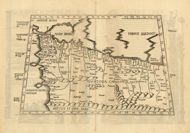
MapMaker: |
Ptolemy/Fries
|
|
| |
| |
Subject: |
Africa - Northern |
|
| |
Period/Size: |
1522-35 / 11.0" x 17.3" (28.0 x 44.0 cm)
|
|
| |
Color: |
Black & White
|
|
| |
Condition: |
(A) A near fine example with fine impression and wide margins. Printed on fine hand laid paper with some show through of text on verso. (condition help) |
|
| |
Source: |
La Geografia |
|
| |
References: |
Manasek p.30. |
|
| |
|
|
| Sales Information |
| |
| |
Price: |
|
|
| |
| |
Offered by: |
Old World Auctions |
|
| |
Catalog: |
Auction No. 115 - Antique Maps, Charts, Atlases & Globes (568) |
|
| |
Lot/Item #: |
733 |
|
| |
| |
Date: |
06/2006
|
|
| |
| |
|