Title:
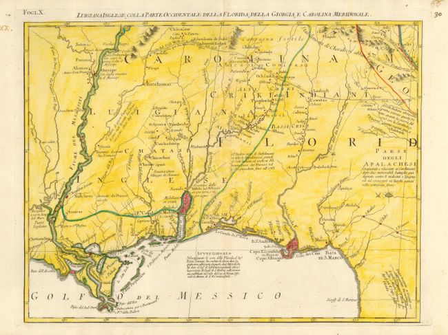
“Luigiana Inglese, colla Parte Occidentale della Florida, della Giorgia, e Carolina Meridionale”
Map Maker:
Antonio Zatta
This map is a great regional map that shows New Or... (full text available to subscribers)
| Item Detail |
| |
| |
MapMaker: |
Antonio Zatta
|
|
| |
| |
Subject: |
Colonial South |
|
| |
Period/Size: |
1778 / 12.5" x 16.5" (31.8 x 42.0 cm)
|
|
| |
Color: |
Colored
|
|
| |
Condition: |
(B) Minor abrasion in a small area east of Mobile Bay and a small pair of wormholes near upper neatline. Printed on thick hand laid paper with original margins. Later full wash coloring in yellow added to the original outline color. (condition help) |
|
| |
Source: |
Atlante Novissimo |
|
| |
References: |
Portinaro & Knirsch #152; Sellers and Van Ee #163. |
|
| |
|
|
| Sales Information |
| |
| |
Price: |
|
|
| |
| |
Offered by: |
Old World Auctions |
|
| |
Catalog: |
Auction No. 116 - Antique Maps, Charts, Atlases & Globes (578) |
|
| |
Lot/Item #: |
164 |
|
| |
| |
Date: |
09/2006
|
|
| |
| |
|
Antique Maps - Valuation and Pricing, Descriptions, Resources |
|
Home |
Information |
Search |
Register |
Contact Us |
Site Map
Americana Exchange, Inc. © 1999 - 2024 Americana Exchange, Inc.. All rights reserved.
OldMaps.com, the OldMaps.com logo and
AMPR are service marks or registered service marks of Americana Exchange, Inc..
|