Title:
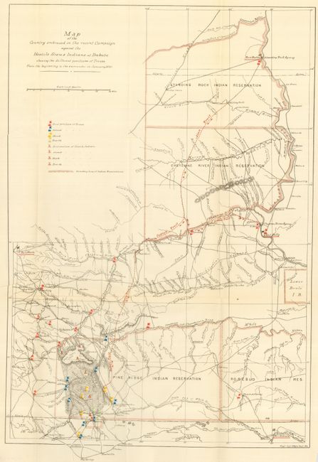
“Map of the Country Embraced in the Recent Campaign against the Hostile Sioux Indians of Dakota Showing the Different Positions of Troops from the Beginning to the Surrender in January, 1891”
Map Maker:
U.S. Army
This is a terrific map of considerable historical ... (full text available to subscribers)
| Item Detail |
| |
| |
MapMaker: |
U.S. Army
|
|
| |
| |
Subject: |
Midwestern United States |
|
| |
Period/Size: |
1891 / 21.3" x 14.8" (54.1 x 37.6 cm)
|
|
| |
Color: |
Colored
|
|
| |
Condition: |
(A+) Folding, as issued with full margins. (condition help) |
|
| |
Source: |
|
|
| |
References: |
|
|
| |
|
|
| Sales Information |
| |
| |
Price: |
|
|
| |
| |
Offered by: |
Old World Auctions |
|
| |
Catalog: |
Auction No. 116 - Antique Maps, Charts, Atlases & Globes (578) |
|
| |
Lot/Item #: |
191 |
|
| |
| |
Date: |
09/2006
|
|
| |
| |
|
Antique Maps - Valuation and Pricing, Descriptions, Resources |
|
Home |
Information |
Search |
Register |
Contact Us |
Site Map
Americana Exchange, Inc. © 1999 - 2024 Americana Exchange, Inc.. All rights reserved.
OldMaps.com, the OldMaps.com logo and
AMPR are service marks or registered service marks of Americana Exchange, Inc..
|