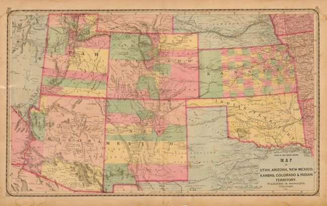
Title:
“Map of Utah, Arizona, New Mexico, Kansas, Colorado, Indian Territory”
Map Maker:
Warner & Higgins
This large double-page map of the Southwest from t... (full text available to subscribers)
| Item Detail |
| |
| |
MapMaker: |
Warner & Higgins
|
|
| |
| |
Subject: |
Southwestern United States |
|
| |
Period/Size: |
1869 / 16.5" x 27.5" (42.0 x 69.9 cm)
|
|
| |
Color: |
Colored
|
|
| |
Condition: |
(B) Dark impression and original full hand coloring. Some marginal chipping and light staining. A little foxing or staining in map image. (condition help) |
|
| |
Source: |
Lloyd's Atlas of the United States |
|
| |
References: |
|
|
| |
|
|
| Sales Information |
| |
| |
Price: |
|
|
| |
| |
Offered by: |
Old World Auctions |
|
| |
Catalog: |
Auction No. 116 - Antique Maps, Charts, Atlases & Globes (578) |
|
| |
Lot/Item #: |
222 |
|
| |
| |
Date: |
09/2006
|
|
| |
| |
|
Antique Maps - Valuation and Pricing, Descriptions, Resources |
|
Home |
Information |
Search |
Register |
Contact Us |
Site Map
Americana Exchange, Inc. © 1999 - 2024 Americana Exchange, Inc.. All rights reserved.
OldMaps.com, the OldMaps.com logo and
AMPR are service marks or registered service marks of Americana Exchange, Inc..
|