Title:
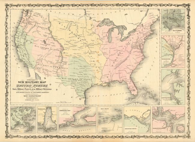
“Johnson's New Military Map of the United States Showing the Forts, Military Posts &c. all the Military Divisions with Enlarged Plans of Southern Harbors…”
Map Maker:
Johnson & Ward
A full view of the United States showing scores of... (full text available to subscribers)
| Item Detail |
| |
| |
MapMaker: |
Johnson & Ward
|
|
| |
| |
Subject: |
United States |
|
| |
Period/Size: |
1861 / 17.2" x 23.5" (43.7 x 59.7 cm)
|
|
| |
Color: |
Colored
|
|
| |
Condition: |
(B) Original light pastel hand coloring with full original margins. Some small spots along centerfold, else very good. (condition help) |
|
| |
Source: |
Illustrated Family Atlas of the World |
|
| |
References: |
|
|
| |
|
|
| Sales Information |
| |
| |
Price: |
|
|
| |
| |
Offered by: |
Old World Auctions |
|
| |
Catalog: |
Auction No. 116 - Antique Maps, Charts, Atlases & Globes (578) |
|
| |
Lot/Item #: |
124 |
|
| |
| |
Date: |
09/2006
|
|
| |
| |
|
Antique Maps - Valuation and Pricing, Descriptions, Resources |
|
Home |
Information |
Search |
Register |
Contact Us |
Site Map
Americana Exchange, Inc. © 1999 - 2024 Americana Exchange, Inc.. All rights reserved.
OldMaps.com, the OldMaps.com logo and
AMPR are service marks or registered service marks of Americana Exchange, Inc..
|