| Item Detail |
| |
| |
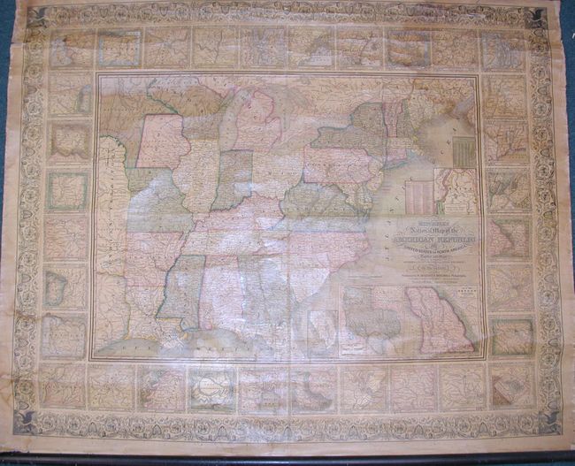
MapMaker: |
Samuel Augustus Mitchell
|
|
| |
| |
Subject: |
Eastern United States |
|
| |
Period/Size: |
1846 / 38.0" x 47.0" (96.6 x 119.4 cm)
|
|
| |
Color: |
Colored
|
|
| |
Condition: |
(A) A really beautiful example. Clean bright impression with relatively clear varnish and no significant flaws. A few areas of light water stain at upper right, lower left, and in extreme upper left corner. The left spindle is missing from bottom rolle (condition help) |
|
| |
Source: |
|
|
| |
References: |
|
|
| |
|
|
| Sales Information |
| |
| |
Price: |
|
|
| |
| |
Offered by: |
Old World Auctions |
|
| |
Catalog: |
Auction No. 116 - Antique Maps, Charts, Atlases & Globes (578) |
|
| |
Lot/Item #: |
141 |
|
| |
| |
Date: |
09/2006
|
|
| |
| |
|