Title:
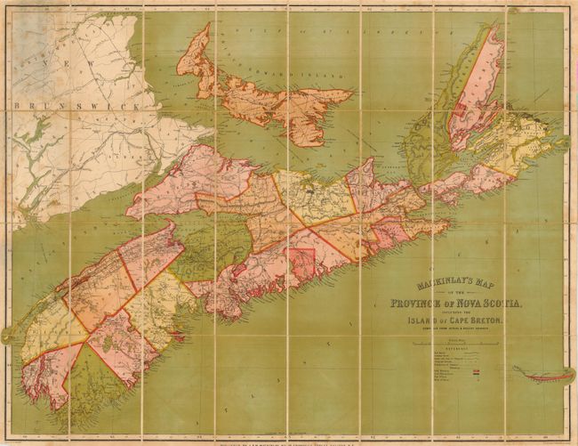
“Mackinlay's Map of the Province of Nova Scotia, Including the Island of Cape Breton. Compiled from Actual & Recent Surveys”
Map Maker:
A. & W. Mackinlay
This very large folding map covers, in addition to... (full text available to subscribers)
| Item Detail |
| |
| |
MapMaker: |
A. & W. Mackinlay
|
|
| |
| |
Subject: |
Canada |
|
| |
Period/Size: |
1865 / 31.0" x 39.0" (78.8 x 99.1 cm)
|
|
| |
Color: |
Colored
|
|
| |
Condition: |
(B) The map has some scattered foxing or toning that is diminished by the strong color. The covers are rubbed with some staining. (condition help) |
|
| |
Source: |
|
|
| |
References: |
|
|
| |
|
|
| Sales Information |
| |
| |
Price: |
|
|
| |
| |
Offered by: |
Old World Auctions |
|
| |
Catalog: |
Auction No. 116 - Antique Maps, Charts, Atlases & Globes (578) |
|
| |
Lot/Item #: |
111 |
|
| |
| |
Date: |
09/2006
|
|
| |
| |
|
Antique Maps - Valuation and Pricing, Descriptions, Resources |
|
Home |
Information |
Search |
Register |
Contact Us |
Site Map
Americana Exchange, Inc. © 1999 - 2024 Americana Exchange, Inc.. All rights reserved.
OldMaps.com, the OldMaps.com logo and
AMPR are service marks or registered service marks of Americana Exchange, Inc..
|