Title:
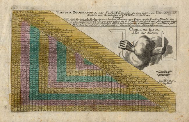
“Tabula Geographica oder Statt-Zeiger darinen zuschen die Distantien Zwischen den Vornehmsten Statten in Europa”
Map Maker:
Johann Michael Probst
This interesting little thematic chart provides di... (full text available to subscribers)
| Item Detail |
| |
| |
MapMaker: |
Johann Michael Probst
|
|
| |
| |
Subject: |
Cartographic Miscellany |
|
| |
Period/Size: |
1789 / 5.7" x 9.5" (14.5 x 24.2 cm)
|
|
| |
Color: |
Colored
|
|
| |
Condition: |
(B) Good impression and original color with some bleed through on verso. Minor scattered foxing. (condition help) |
|
| |
Source: |
Atlas Minor ex Tabulis Geographicis |
|
| |
References: |
|
|
| |
|
|
| Sales Information |
| |
| |
Price: |
|
|
| |
| |
Offered by: |
Old World Auctions |
|
| |
Catalog: |
Auction No. 116 - Antique Maps, Charts, Atlases & Globes (578) |
|
| |
Lot/Item #: |
056 |
|
| |
| |
Date: |
09/2006
|
|
| |
| |
|
Antique Maps - Valuation and Pricing, Descriptions, Resources |
|
Home |
Information |
Search |
Register |
Contact Us |
Site Map
Americana Exchange, Inc. © 1999 - 2024 Americana Exchange, Inc.. All rights reserved.
OldMaps.com, the OldMaps.com logo and
AMPR are service marks or registered service marks of Americana Exchange, Inc..
|