| Item Detail |
| |
| |
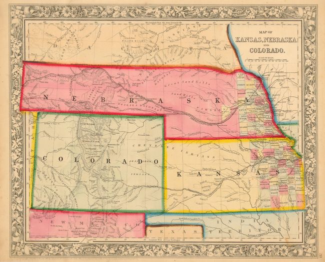
MapMaker: |
Samuel Augustus Mitchell
|
|
| |
| |
Subject: |
Central United States, Kansas, Nebraska, Colorado |
|
| |
Period/Size: |
1862 / 11.3" x 14.0" (28.7 x 35.6 cm)
|
|
| |
Color: |
Colored
|
|
| |
Condition: |
(B) Fine impression and strong original color. A couple insignificant spots, close trimmed (1/4") top and bottom, else nearly fine. (condition help) |
|
| |
Source: |
|
|
| |
References: |
|
|
| |
|
|
| Sales Information |
| |
| |
Price: |
|
|
| |
| |
Offered by: |
Old World Auctions |
|
| |
Catalog: |
Auction No. 116 - Antique Maps, Charts, Atlases & Globes (578) |
|
| |
Lot/Item #: |
189 |
|
| |
| |
Date: |
09/2006
|
|
| |
| |
|