Title:
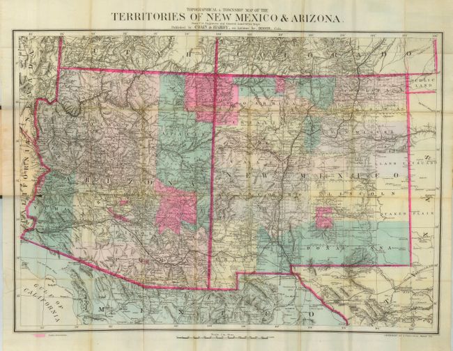
“Topographical & Township Map of the Territories of New Mexico & Arizona from U.S. Engineers and General Land Office Maps”
Map Maker:
Chain, Hardy & Co.
This rare and highly desirable map was produced by... (full text available to subscribers)
| Item Detail |
| |
| |
MapMaker: |
Chain, Hardy & Co.
|
|
| |
| |
Subject: |
Southwestern United States |
|
| |
Period/Size: |
1881 / 19.6" x 28.0" (49.8 x 71.2 cm)
|
|
| |
Color: |
Colored
|
|
| |
Condition: |
(B) Very fine color and impression on fine watermarked banknote paper with full margins. Some fold intersection splits and one short split at margin cleanly into map, all easily repaired. Cover is in very good condition as well. (condition help) |
|
| |
Source: |
|
|
| |
References: |
|
|
| |
|
|
| Sales Information |
| |
| |
Price: |
|
|
| |
| |
Offered by: |
Old World Auctions |
|
| |
Catalog: |
Auction No. 116 - Antique Maps, Charts, Atlases & Globes (578) |
|
| |
Lot/Item #: |
224 |
|
| |
| |
Date: |
09/2006
|
|
| |
| |
|
Antique Maps - Valuation and Pricing, Descriptions, Resources |
|
Home |
Information |
Search |
Register |
Contact Us |
Site Map
Americana Exchange, Inc. © 1999 - 2024 Americana Exchange, Inc.. All rights reserved.
OldMaps.com, the OldMaps.com logo and
AMPR are service marks or registered service marks of Americana Exchange, Inc..
|