Rister or Sign In to see pricing information


Title:

Kaart van Nieuw Ijork Eiland Een gedeelte van Long Eiland… 27 Augustus 1776

Map Maker:

John Marshall

Kaart van Nieuw Ijork Eiland Een gedeelte van Long Eiland… 27 Augustus 1776

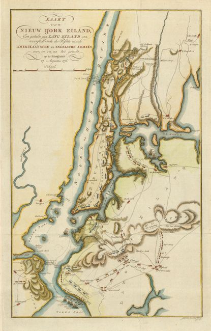
Dutch version of this terrific Revolutionary Wa... (full text available to subscribers)
Item Detail
 
  MapMaker:  

John Marshall


  Subject:  New York  
  Period/Size:  1805-09 / 15.8" x 9.8"  (40.2 x 24.9 cm)  
  Color:  Colored  
  Condition:  (A+) Nice impression printed on heavy paper with attractive later color. Issued folding, now pressed. (condition help)  
  Source:  Hetleven van George Washington…  
  References:   
 
 
Sales Information
 
  Price: 

Please register your email to view records, or sign in with email address to see records


  Offered by:  Old World Auctions  
  Catalog:  Auction No. 116 - Antique Maps, Charts, Atlases & Globes (578)  
  Lot/Item #:  286  
 
  Date:  09/2006  


Antique Maps - Valuation and Pricing, Descriptions, Resources


Home | Information | Search | Register | Contact Us | Site Map

Americana Exchange, Inc. © 1999 - 2024 Americana Exchange, Inc.. All rights reserved. OldMaps.com, the OldMaps.com logo and
AMPR are service marks or registered service marks of Americana Exchange, Inc..