Title:
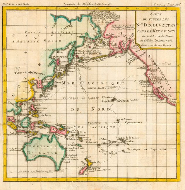
“Carte de Toutes les Nles. Decouvertes Dans la Mer du Sud, ou est tracee la Route du Celebre Capitaine Cook, dans son dernier Voyage”
Map Maker:
Louis Brion de la Tour
Small copper engraved map that illustrates the voy... (full text available to subscribers)
| Item Detail |
| |
| |
MapMaker: |
Louis Brion de la Tour
|
|
| |
| |
Subject: |
Pacific Ocean |
|
| |
Period/Size: |
1790 / 9.0" x 9.0" (22.9 x 22.9 cm)
|
|
| |
Color: |
Colored
|
|
| |
Condition: |
(B) Issued folding, now pressed. Some faint foxing. (condition help) |
|
| |
Source: |
Histoire Universelle |
|
| |
References: |
|
|
| |
|
|
| Sales Information |
| |
| |
Price: |
|
|
| |
| |
Offered by: |
Old World Auctions |
|
| |
Catalog: |
Auction No. 116 - Antique Maps, Charts, Atlases & Globes (578) |
|
| |
Lot/Item #: |
823 |
|
| |
| |
Date: |
09/2006
|
|
| |
| |
|
Antique Maps - Valuation and Pricing, Descriptions, Resources |
|
Home |
Information |
Search |
Register |
Contact Us |
Site Map
Americana Exchange, Inc. © 1999 - 2024 Americana Exchange, Inc.. All rights reserved.
OldMaps.com, the OldMaps.com logo and
AMPR are service marks or registered service marks of Americana Exchange, Inc..
|