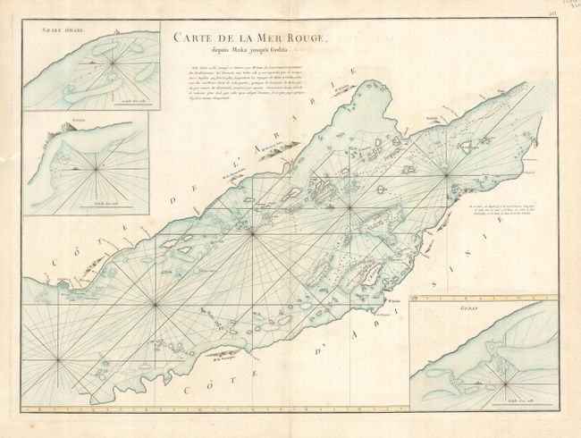
Title:
“Carte de la Mer Rouge depuis Moka jusqu'a Gedda”
Map Maker:
Jean B.N.D. d' Apres de Mannevillette
Very interesting and detailed chart of the Red Sea... (full text available to subscribers)
| Item Detail |
| |
| |
MapMaker: |
Jean B.N.D. d' Apres de Mannevillette
|
|
| |
| |
Subject: |
Red Sea |
|
| |
Period/Size: |
1775 / 19.0" x 26.0" (48.3 x 66.1 cm)
|
|
| |
Color: |
Colored
|
|
| |
Condition: |
(B) A small infilled hole near centerfold under title. Light crease on right side of map and a few very light spots of foxing. (condition help) |
|
| |
Source: |
Le Neptune Oriental. . . |
|
| |
References: |
Phillips (A) #3165-26. |
|
| |
|
|
| Sales Information |
| |
| |
Price: |
|
|
| |
| |
Offered by: |
Old World Auctions |
|
| |
Catalog: |
Auction No. 117 - Antique Maps, Charts, Atlases & Globes (579) |
|
| |
Lot/Item #: |
750 |
|
| |
| |
Date: |
12/2006
|
|
| |
| |
|
Antique Maps - Valuation and Pricing, Descriptions, Resources |
|
Home |
Information |
Search |
Register |
Contact Us |
Site Map
Americana Exchange, Inc. © 1999 - 2024 Americana Exchange, Inc.. All rights reserved.
OldMaps.com, the OldMaps.com logo and
AMPR are service marks or registered service marks of Americana Exchange, Inc..
|