| Item Detail |
| |
| |
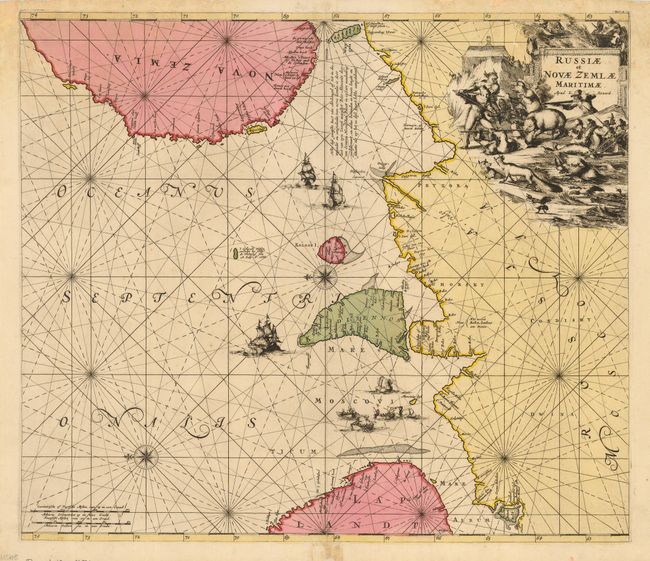
MapMaker: |
Louis Renard
|
|
| |
| |
Subject: |
Russia |
|
| |
Period/Size: |
1715 / 19.3" x 22.3" (49.1 x 56.7 cm)
|
|
| |
Color: |
Colored
|
|
| |
Condition: |
(B) Gorgeous, dark impression and fine, original coloring. Marginal damage to upper corners and bottom centerfold with some old professional repairs, not affecting map. Backed with Japanese tissue. (condition help) |
|
| |
Source: |
Atlas de la Navigation et du Commerce |
|
| |
References: |
|
|
| |
|
|
| Sales Information |
| |
| |
Price: |
|
|
| |
| |
Offered by: |
Old World Auctions |
|
| |
Catalog: |
Auction No. 117 - Antique Maps, Charts, Atlases & Globes (579) |
|
| |
Lot/Item #: |
607 |
|
| |
| |
Date: |
12/2006
|
|
| |
| |
|