Title:
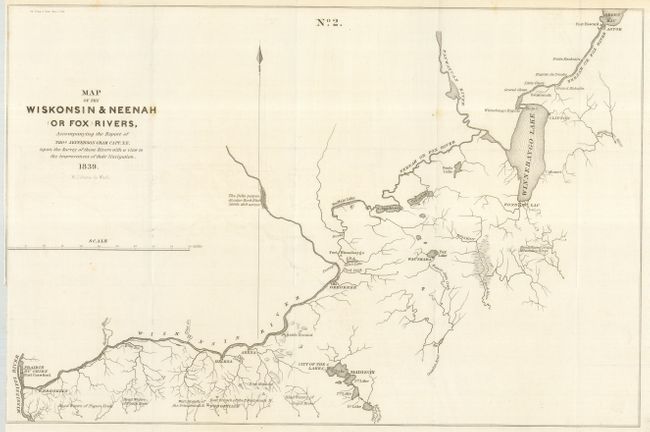
“Map of the Wiskonsin & Neenah (or Fox) Rivers, Accompanying the Report of Thos. Jefferson Cram, Capt. T. E., under the Survey of Those Rivers with a View to the Improvement of Their Navigation”
Map Maker:
U.S. Government
This map is from a series of maps that explored th... (full text available to subscribers)
| Item Detail |
| |
| |
MapMaker: |
U.S. Government
|
|
| |
| |
Subject: |
Wisconsin |
|
| |
Period/Size: |
1839 / 11.4" x 17.2" (29.0 x 43.7 cm)
|
|
| |
Color: |
Black & White
|
|
| |
Condition: |
(A) Folded map with closely trimmed binding side as issued, missing a bit of the neatline on that side. Scotch Conservation and Preservation Tape #888 closing a tear on the verso. Otherwise near fine with clean, strong paper. (condition help) |
|
| |
Source: |
Doc. 318, 26th Cong. 1st Session |
|
| |
References: |
|
|
| |
|
|
| Sales Information |
| |
| |
Price: |
|
|
| |
| |
Offered by: |
Old World Auctions |
|
| |
Catalog: |
Auction No. 117 - Antique Maps, Charts, Atlases & Globes (579) |
|
| |
Lot/Item #: |
348 |
|
| |
| |
Date: |
12/2006
|
|
| |
| |
|
Antique Maps - Valuation and Pricing, Descriptions, Resources |
|
Home |
Information |
Search |
Register |
Contact Us |
Site Map
Americana Exchange, Inc. © 1999 - 2024 Americana Exchange, Inc.. All rights reserved.
OldMaps.com, the OldMaps.com logo and
AMPR are service marks or registered service marks of Americana Exchange, Inc..
|