Title:
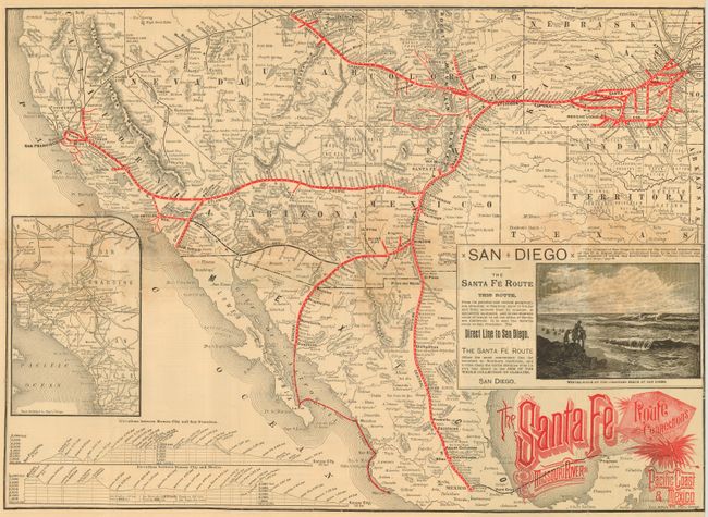
“The Santa Fe Route and Connections Missouri River to Pacific Coast & Mexico”
Map Maker:
Railroad Companies
Folding map and timetable for the Santa Fe Route, ... (full text available to subscribers)
| Item Detail |
| |
| |
MapMaker: |
Railroad Companies
|
|
| |
| |
Subject: |
United States & Mexico |
|
| |
Period/Size: |
1886 / 15.3" x 21.3" (38.9 x 54.1 cm)
|
|
| |
Color: |
Colored
|
|
| |
Condition: |
(B) Generally good with some toning at the center along folds and a couple of fold intersection splits. (condition help) |
|
| |
Source: |
|
|
| |
References: |
|
|
| |
|
|
| Sales Information |
| |
| |
Price: |
|
|
| |
| |
Offered by: |
Old World Auctions |
|
| |
Catalog: |
Auction No. 117 - Antique Maps, Charts, Atlases & Globes (579) |
|
| |
Lot/Item #: |
363 |
|
| |
| |
Date: |
12/2006
|
|
| |
| |
|
Antique Maps - Valuation and Pricing, Descriptions, Resources |
|
Home |
Information |
Search |
Register |
Contact Us |
Site Map
Americana Exchange, Inc. © 1999 - 2024 Americana Exchange, Inc.. All rights reserved.
OldMaps.com, the OldMaps.com logo and
AMPR are service marks or registered service marks of Americana Exchange, Inc..
|