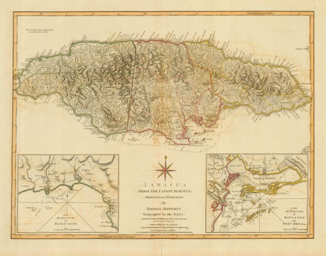
Title:
“Jamaica from the Latest Surveys”
Map Maker:
Thomas Jefferys
This detailed map of Jamaica shows the parishes, t... (full text available to subscribers)
| Item Detail |
| |
| |
MapMaker: |
Thomas Jefferys
|
|
| |
| |
Subject: |
Jamaica |
|
| |
Period/Size: |
1794 / 18.3" x 24.5" (46.5 x 62.3 cm)
|
|
| |
Color: |
Colored
|
|
| |
Condition: |
(B) Some offsetting throughout and toning on centerfold. Fold separations closed with archival tape in margins. Tear in margin closed with cello tape. (condition help) |
|
| |
Source: |
|
|
| |
References: |
Sellers & Van Ee #1930 (1775 ed.). |
|
| |
|
|
| Sales Information |
| |
| |
Price: |
|
|
| |
| |
Offered by: |
Old World Auctions |
|
| |
Catalog: |
Auction No. 117 - Antique Maps, Charts, Atlases & Globes (579) |
|
| |
Lot/Item #: |
387 |
|
| |
| |
Date: |
12/2006
|
|
| |
| |
|
Antique Maps - Valuation and Pricing, Descriptions, Resources |
|
Home |
Information |
Search |
Register |
Contact Us |
Site Map
Americana Exchange, Inc. © 1999 - 2024 Americana Exchange, Inc.. All rights reserved.
OldMaps.com, the OldMaps.com logo and
AMPR are service marks or registered service marks of Americana Exchange, Inc..
|