Title:
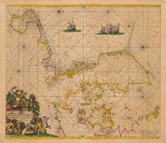
“Daniae, Frisiae, Groningae et Orientalis Frisiae Littora”
Map Maker:
Frederick de Wit
Interesting, rhumb-line filled sea chart that is c... (full text available to subscribers)
| Item Detail |
| |
| |
MapMaker: |
Frederick de Wit
|
|
| |
| |
Subject: |
Europe - Northern |
|
| |
Period/Size: |
1675 / 19.3" x 22.3" (49.1 x 56.7 cm)
|
|
| |
Color: |
Colored
|
|
| |
Condition: |
(C) Sharp impression with original color. There is a spot of offsetting and loss in the lower centerfold due to verdigris oxidation that is reinforced with a little archival tape on verso. Light, scattered foxing throughout. (condition help) |
|
| |
Source: |
Orbis Maritimus ofte Zee Atlas |
|
| |
References: |
|
|
| |
|
|
| Sales Information |
| |
| |
Price: |
|
|
| |
| |
Offered by: |
Old World Auctions |
|
| |
Catalog: |
Auction No. 117 - Antique Maps, Charts, Atlases & Globes (579) |
|
| |
Lot/Item #: |
473 |
|
| |
| |
Date: |
12/2006
|
|
| |
| |
|
Antique Maps - Valuation and Pricing, Descriptions, Resources |
|
Home |
Information |
Search |
Register |
Contact Us |
Site Map
Americana Exchange, Inc. © 1999 - 2024 Americana Exchange, Inc.. All rights reserved.
OldMaps.com, the OldMaps.com logo and
AMPR are service marks or registered service marks of Americana Exchange, Inc..
|