| Item Detail |
| |
| |
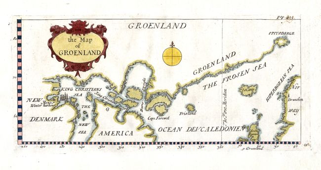
MapMaker: |
John Churchill
|
|
| |
| |
Subject: |
North Atlantic - Greenland & Canada |
|
| |
Period/Size: |
1704 / 5.0" x 11.0" (12.7 x 28.0 cm)
|
|
| |
Color: |
Colored
|
|
| |
Condition: |
(B) Sharp impression with attractive coloring. Some early manuscript on pagination at upper right, hinge remnants on upper blank margin. (condition help) |
|
| |
Source: |
A Collection of Voyages and Travels |
|
| |
References: |
cf Burden #285. |
|
| |
|
|
| Sales Information |
| |
| |
Price: |
|
|
| |
| |
Offered by: |
Old World Auctions |
|
| |
Catalog: |
Auction No. 117 - Antique Maps, Charts, Atlases & Globes (579) |
|
| |
Lot/Item #: |
424 |
|
| |
| |
Date: |
12/2006
|
|
| |
| |
|