| Item Detail |
| |
| |
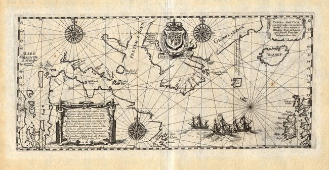
MapMaker: |
Theodore de Bry
|
|
| |
| |
Subject: |
North Atlantic - Canada, Greenland and Iceland |
|
| |
Period/Size: |
1613 / 5.8" x 12.8" (14.8 x 32.6 cm)
|
|
| |
Color: |
Black & White
|
|
| |
Condition: |
(A) Incredibly sharp impression with just two tiny spots of foxing. Light toning in wide, original margins. (condition help) |
|
| |
Source: |
Petits Voyages |
|
| |
References: |
Burden: #165; Kershaw: #55. |
|
| |
|
|
| Sales Information |
| |
| |
Price: |
|
|
| |
| |
Offered by: |
Old World Auctions |
|
| |
Catalog: |
Auction No. 117 - Antique Maps, Charts, Atlases & Globes (579) |
|
| |
Lot/Item #: |
422 |
|
| |
| |
Date: |
12/2006
|
|
| |
| |
|