| Item Detail |
| |
| |
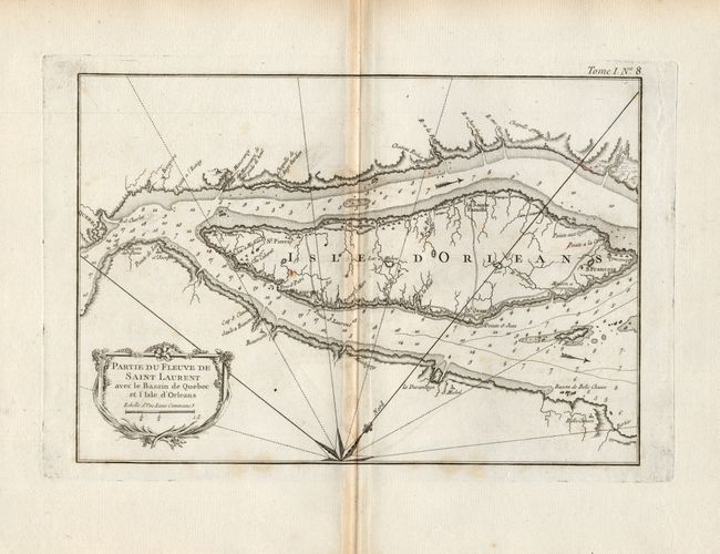
MapMaker: |
Jacques Nicolas Bellin
|
|
| |
| |
Subject: |
Canada |
|
| |
Period/Size: |
1764 / 8.0" x 11.6" (20.4 x 29.5 cm)
|
|
| |
Color: |
Black & White
|
|
| |
Condition: |
(B) Printed on a sheet of hand laid paper with very wide margins and watermark. Toned along centerfold and at extreme edges of margins, else very good. (condition help) |
|
| |
Source: |
Le Petit Atlas Maritime |
|
| |
References: |
Kershaw #662 |
|
| |
|
|
| Sales Information |
| |
| |
Price: |
|
|
| |
| |
Offered by: |
Old World Auctions |
|
| |
Catalog: |
Auction No. 117 - Antique Maps, Charts, Atlases & Globes (579) |
|
| |
Lot/Item #: |
107 |
|
| |
| |
Date: |
12/2006
|
|
| |
| |
|