Title:
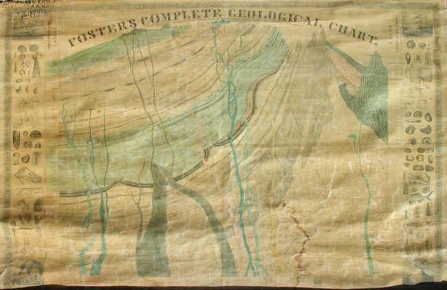
“Foster's Complete Geological Chart. Exhibiting in their Successive Order of Deposition, the Various Rocks, Which Form the Crust of our Globe, Arranged According to the Best Authorities in Europe & America”
Map Maker:
J.T. Foster
A fascinating geological chart showing a cross-sec... (full text available to subscribers)
| Item Detail |
| |
| |
MapMaker: |
J.T. Foster
|
|
| |
| |
Subject: |
United States |
|
| |
Period/Size: |
1849 / 47.5" x 67.5" (120.7 x 171.5 cm)
|
|
| |
Color: |
Colored
|
|
| |
Condition: |
(B) With both original rollers attached. Generally very nice condition with clear varnish and few flaws. Some water stains at bottom and top center. Short split in linen at top left in border where it attaches to roller. The map was titled on verso wi (condition help) |
|
| |
Source: |
|
|
| |
References: |
|
|
| |
|
|
| Sales Information |
| |
| |
Price: |
|
|
| |
| |
Offered by: |
Old World Auctions |
|
| |
Catalog: |
Auction No. 117 - Antique Maps, Charts, Atlases & Globes (579) |
|
| |
Lot/Item #: |
141 |
|
| |
| |
Date: |
12/2006
|
|
| |
| |
|
Antique Maps - Valuation and Pricing, Descriptions, Resources |
|
Home |
Information |
Search |
Register |
Contact Us |
Site Map
Americana Exchange, Inc. © 1999 - 2024 Americana Exchange, Inc.. All rights reserved.
OldMaps.com, the OldMaps.com logo and
AMPR are service marks or registered service marks of Americana Exchange, Inc..
|