Rister or Sign In to see pricing information


Title:

A New Map of Swisserland, Divided into Its Cantons and Dependencies, Including the Grisons &c &c…

Map Maker:

John Cary

A New Map of Swisserland, Divided into Its Cantons and Dependencies, Including the Grisons &c &c…

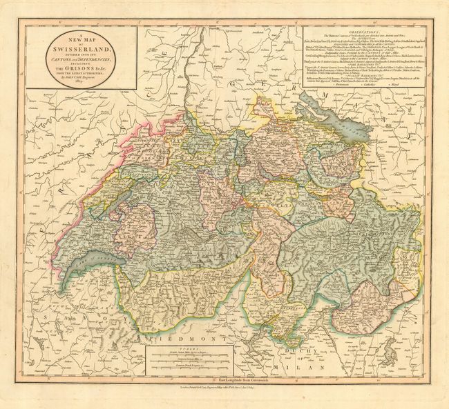
This is a very handsome and detailed map of Switze... (full text available to subscribers)
Item Detail
 
  MapMaker:  

John Cary


  Subject:  Switzerland  
  Period/Size:  1819 / 17.8" x 20.3"  (45.3 x 51.6 cm)  
  Color:  Colored  
  Condition:  (A) Very crisp impression with nice, original color. There is some light soil and a short tear in the blank margins, a couple of tiny spots of foxing in map. (condition help)  
  Source:   
  References:   
 
 
Sales Information
 
  Price: 

Please register your email to view records, or sign in with email address to see records


  Offered by:  Old World Auctions  
  Catalog:  Auction No. 117 - Antique Maps, Charts, Atlases & Globes (579)  
  Lot/Item #:  551  
 
  Date:  12/2006  


Antique Maps - Valuation and Pricing, Descriptions, Resources


Home | Information | Search | Register | Contact Us | Site Map

Americana Exchange, Inc. © 1999 - 2024 Americana Exchange, Inc.. All rights reserved. OldMaps.com, the OldMaps.com logo and
AMPR are service marks or registered service marks of Americana Exchange, Inc..