Title:
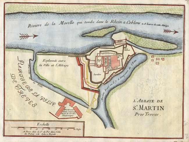
“L'Abbaye de St. Martin Pres Treves”
Map Maker:
Nicolas de Fer
This plan shows the fortifications of the Abbey of... (full text available to subscribers)
| Item Detail |
| |
| |
MapMaker: |
Nicolas de Fer
|
|
| |
| |
Subject: |
Germany |
|
| |
Period/Size: |
1691 / 8.4" x 11.0" (21.4 x 28.0 cm)
|
|
| |
Color: |
Colored
|
|
| |
Condition: |
(A) (condition help) |
|
| |
Source: |
Les Forces de l' Europe… |
|
| |
References: |
Pollak #21, pp.40-43. |
|
| |
|
|
| Sales Information |
| |
| |
Price: |
|
|
| |
| |
Offered by: |
Old World Auctions |
|
| |
Catalog: |
Auction No. 117 - Antique Maps, Charts, Atlases & Globes (579) |
|
| |
Lot/Item #: |
571 |
|
| |
| |
Date: |
12/2006
|
|
| |
| |
|
Antique Maps - Valuation and Pricing, Descriptions, Resources |
|
Home |
Information |
Search |
Register |
Contact Us |
Site Map
Americana Exchange, Inc. © 1999 - 2024 Americana Exchange, Inc.. All rights reserved.
OldMaps.com, the OldMaps.com logo and
AMPR are service marks or registered service marks of Americana Exchange, Inc..
|