Title:
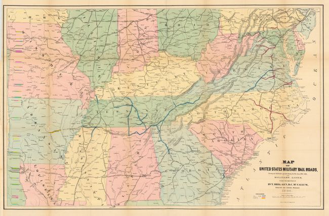
“Map of United States Military Rail Roads, Showing the Rail Roads operated during the War from 1862 - 1866 as Military Lines”
Map Maker:
U.S. Government
An interesting hand colored map lithographed by J.... (full text available to subscribers)
| Item Detail |
| |
| |
MapMaker: |
U.S. Government
|
|
| |
| |
Subject: |
Southern United States |
|
| |
Period/Size: |
1866 / 25.0" x 38.0" (63.5 x 96.6 cm)
|
|
| |
Color: |
Colored
|
|
| |
Condition: |
(B) Lightly toned along some folds with tiny loss at two fold intersections, else very good. Issued folded, now backed with archival tissue. (condition help) |
|
| |
Source: |
|
|
| |
References: |
|
|
| |
|
|
| Sales Information |
| |
| |
Price: |
|
|
| |
| |
Offered by: |
Old World Auctions |
|
| |
Catalog: |
Auction No. 117 - Antique Maps, Charts, Atlases & Globes (579) |
|
| |
Lot/Item #: |
172 |
|
| |
| |
Date: |
12/2006
|
|
| |
| |
|
Antique Maps - Valuation and Pricing, Descriptions, Resources |
|
Home |
Information |
Search |
Register |
Contact Us |
Site Map
Americana Exchange, Inc. © 1999 - 2024 Americana Exchange, Inc.. All rights reserved.
OldMaps.com, the OldMaps.com logo and
AMPR are service marks or registered service marks of Americana Exchange, Inc..
|