Title:
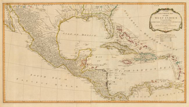
“A New and Complete Map of the West Indies Comprehending all the Coasts and Islands Known by That Name”
Map Maker:
Laurie & Whittle
This large, two-sheet, chart of the Gulf of Mexico... (full text available to subscribers)
| Item Detail |
| |
| |
MapMaker: |
Laurie & Whittle
|
|
| |
| |
Subject: |
Gulf of Mexico and Caribbean |
|
| |
Period/Size: |
1794 / 18.3" x 33.5" (46.5 x 85.1 cm)
|
|
| |
Color: |
Colored
|
|
| |
Condition: |
(A) Original outline color. Some faint offsetting, still overall very good. (condition help) |
|
| |
Source: |
A New and Elegant Imperial Sheet Atlas |
|
| |
References: |
Phillips (A) #6009-64. |
|
| |
|
|
| Sales Information |
| |
| |
Price: |
|
|
| |
| |
Offered by: |
Old World Auctions |
|
| |
Catalog: |
Auction No. 117 - Antique Maps, Charts, Atlases & Globes (579) |
|
| |
Lot/Item #: |
374 |
|
| |
| |
Date: |
12/2006
|
|
| |
| |
|
Antique Maps - Valuation and Pricing, Descriptions, Resources |
|
Home |
Information |
Search |
Register |
Contact Us |
Site Map
Americana Exchange, Inc. © 1999 - 2024 Americana Exchange, Inc.. All rights reserved.
OldMaps.com, the OldMaps.com logo and
AMPR are service marks or registered service marks of Americana Exchange, Inc..
|