| Item Detail |
| |
| |
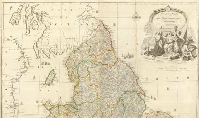
MapMaker: |
John Rocque
|
|
| |
| |
Subject: |
England & Wales |
|
| |
Period/Size: |
1761 / 46.0" x 39.0" (116.9 x 99.1 cm)
|
|
| |
Color: |
Colored
|
|
| |
Condition: |
(B) Crisp impression and fine hand coloring in outline. A couple spots and a little toning along some folds & a few flaws at fold intersections, but near very good. Backed with Japanese paper. (condition help) |
|
| |
Source: |
General Atlas |
|
| |
References: |
Rumsey #2594 (southern sheet only). |
|
| |
|
|
| Sales Information |
| |
| |
Price: |
|
|
| |
| |
Offered by: |
Old World Auctions |
|
| |
Catalog: |
Auction No. 117 - Antique Maps, Charts, Atlases & Globes (579) |
|
| |
Lot/Item #: |
451 |
|
| |
| |
Date: |
12/2006
|
|
| |
| |
|