Title:
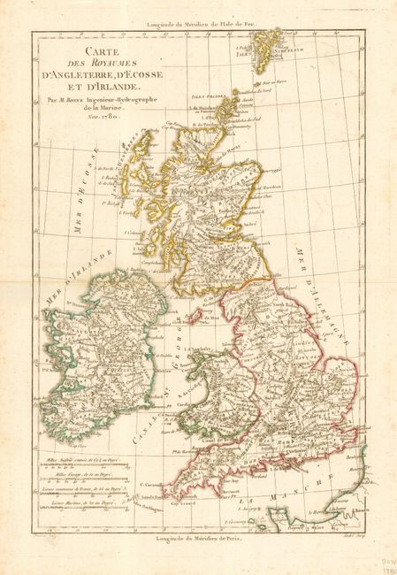
“Carte des Royaumes d'Angleterre, d'Ecosse et d'Irlande”
Map Maker:
Rigobert Bonne
Nicely detailed map of the British Isles including... (full text available to subscribers)
| Item Detail |
| |
| |
MapMaker: |
Rigobert Bonne
|
|
| |
| |
Subject: |
British Isles |
|
| |
Period/Size: |
1780 / 12.5" x 8.4" (31.8 x 21.4 cm)
|
|
| |
Color: |
Colored
|
|
| |
Condition: |
(A) Printed on good, heavy paper with a small amount of marginal foxing. (condition help) |
|
| |
Source: |
Atlas Portatif |
|
| |
References: |
|
|
| |
|
|
| Sales Information |
| |
| |
Price: |
|
|
| |
| |
Offered by: |
Old World Auctions |
|
| |
Catalog: |
Auction No. 119 - Antique Maps, Charts, Atlases & Globes (585) |
|
| |
Lot/Item #: |
463 |
|
| |
| |
Date: |
05/2007
|
|
| |
| |
|
Antique Maps - Valuation and Pricing, Descriptions, Resources |
|
Home |
Information |
Search |
Register |
Contact Us |
Site Map
Americana Exchange, Inc. © 1999 - 2024 Americana Exchange, Inc.. All rights reserved.
OldMaps.com, the OldMaps.com logo and
AMPR are service marks or registered service marks of Americana Exchange, Inc..
|