Title:
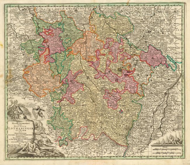
“Mappa Geographica in qua Ducatus Lotharingiae et Barr ut et Episcopatuum Metens, Tullens, Verdunens…”
Map Maker:
Matthaus Seutter
This is a very decorative map of the Lorraine regi... (full text available to subscribers)
| Item Detail |
| |
| |
MapMaker: |
Matthaus Seutter
|
|
| |
| |
Subject: |
France |
|
| |
Period/Size: |
1730 / 19.4" x 22.6" (49.3 x 57.4 cm)
|
|
| |
Color: |
Colored
|
|
| |
Condition: |
(B) Printed on thick paper with a couple small stains and a small printer's smudge in the cartouche. (condition help) |
|
| |
Source: |
|
|
| |
References: |
|
|
| |
|
|
| Sales Information |
| |
| |
Price: |
|
|
| |
| |
Offered by: |
Old World Auctions |
|
| |
Catalog: |
Auction No. 119 - Antique Maps, Charts, Atlases & Globes (585) |
|
| |
Lot/Item #: |
573 |
|
| |
| |
Date: |
05/2007
|
|
| |
| |
|
Antique Maps - Valuation and Pricing, Descriptions, Resources |
|
Home |
Information |
Search |
Register |
Contact Us |
Site Map
Americana Exchange, Inc. © 1999 - 2024 Americana Exchange, Inc.. All rights reserved.
OldMaps.com, the OldMaps.com logo and
AMPR are service marks or registered service marks of Americana Exchange, Inc..
|