| Item Detail |
| |
| |
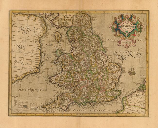
MapMaker: |
Mercator/Hondius
|
|
| |
| |
Subject: |
England & Wales |
|
| |
Period/Size: |
1613 / 13.8" x 18.0" (35.1 x 45.8 cm)
|
|
| |
Color: |
Colored
|
|
| |
Condition: |
(A) Toned with attractive original color. A small hole in the lower right margin, well away from the map. One spot in the Irish Sea, still overall very good. (condition help) |
|
| |
Source: |
|
|
| |
References: |
Shirley (BI) #181; Van der Krogt (Atlantes) #5100:1A.1. |
|
| |
|
|
| Sales Information |
| |
| |
Price: |
|
|
| |
| |
Offered by: |
Old World Auctions |
|
| |
Catalog: |
Auction No. 119 - Antique Maps, Charts, Atlases & Globes (585) |
|
| |
Lot/Item #: |
476 |
|
| |
| |
Date: |
05/2007
|
|
| |
| |
|