| Item Detail |
| |
| |
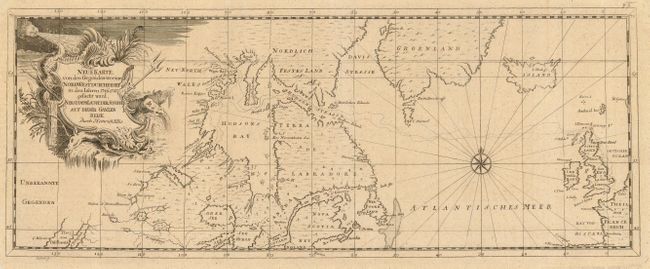
MapMaker: |
Henry Ellis
|
|
| |
| |
Subject: |
Canada and North Atlantic |
|
| |
Period/Size: |
1750 / 6.8" x 17.5" (17.3 x 44.5 cm)
|
|
| |
Color: |
Black & White
|
|
| |
Condition: |
(A) Very crisp engraving. Hinge remnants on verso, small tear at upper right corner margin, just short of neatline. (condition help) |
|
| |
Source: |
Reise nach Hudsons Merrbusen |
|
| |
References: |
cf Kershaw #439. |
|
| |
|
|
| Sales Information |
| |
| |
Price: |
|
|
| |
| |
Offered by: |
Old World Auctions |
|
| |
Catalog: |
Auction No. 118 - Antique Maps, Charts, Atlases & Globes (584) |
|
| |
Lot/Item #: |
164 |
|
| |
| |
Date: |
03/2007
|
|
| |
| |
|