Title:
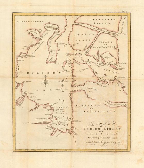
“A Chart of Hudson's Straits and Bay, According to the Discoveries made between the Years 1610 & 1743”
Map Maker:
Charles Swaine & Drage
This is the first edition of this scarce map of Hu... (full text available to subscribers)
| Item Detail |
| |
| |
MapMaker: |
Charles Swaine & Drage
|
|
| |
| |
Subject: |
Canada - Hudson Bay |
|
| |
Period/Size: |
1749 / 13.4" x 11.5" (34.1 x 29.3 cm)
|
|
| |
Color: |
Colored
|
|
| |
Condition: |
(B) Generally good with some toning and a couple tiny fold separations. Hinge remnants at top margin. (condition help) |
|
| |
Source: |
An Account of a Voyage for Discovery of a North-West Passage by Hudson's Streigh |
|
| |
References: |
Kershaw #430. |
|
| |
|
|
| Sales Information |
| |
| |
Price: |
|
|
| |
| |
Offered by: |
Old World Auctions |
|
| |
Catalog: |
Auction No. 118 - Antique Maps, Charts, Atlases & Globes (584) |
|
| |
Lot/Item #: |
172 |
|
| |
| |
Date: |
03/2007
|
|
| |
| |
|
Antique Maps - Valuation and Pricing, Descriptions, Resources |
|
Home |
Information |
Search |
Register |
Contact Us |
Site Map
Americana Exchange, Inc. © 1999 - 2024 Americana Exchange, Inc.. All rights reserved.
OldMaps.com, the OldMaps.com logo and
AMPR are service marks or registered service marks of Americana Exchange, Inc..
|