Title:
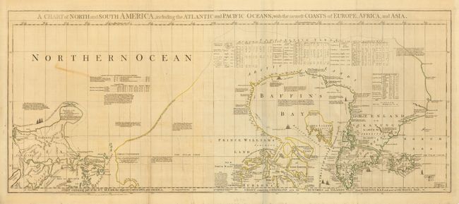
“A Chart of North and South America, including the Atlantic and Pacific Oceans…”
Map Maker:
Jefferys/Sayer & Bennett
This is the top sheet of Jeffreys' large and impor... (full text available to subscribers)
| Item Detail |
| |
| |
MapMaker: |
Jefferys/Sayer & Bennett
|
|
| |
| |
Subject: |
Canadian Arctic, Hudson Bay and Alaska |
|
| |
Period/Size: |
1775 / 18.0" x 43.5" (45.8 x 110.5 cm)
|
|
| |
Color: |
Colored
|
|
| |
Condition: |
(B) Original outline color. A couple of stains in map & one soft crease. There is a little old masking tape on verso and at the top blank margin. (condition help) |
|
| |
Source: |
The American Atlas |
|
| |
References: |
Kershaw # 450. |
|
| |
|
|
| Sales Information |
| |
| |
Price: |
|
|
| |
| |
Offered by: |
Old World Auctions |
|
| |
Catalog: |
Auction No. 118 - Antique Maps, Charts, Atlases & Globes (584) |
|
| |
Lot/Item #: |
192 |
|
| |
| |
Date: |
03/2007
|
|
| |
| |
|
Antique Maps - Valuation and Pricing, Descriptions, Resources |
|
Home |
Information |
Search |
Register |
Contact Us |
Site Map
Americana Exchange, Inc. © 1999 - 2024 Americana Exchange, Inc.. All rights reserved.
OldMaps.com, the OldMaps.com logo and
AMPR are service marks or registered service marks of Americana Exchange, Inc..
|