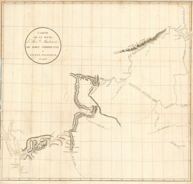
Title:
“Carte de la Route d'Alexdre. Mackenzie, du Fort Chipiouyan a l' Ocean Pacifique, en 1793”
Map Maker:
Alexander Mackenzie
Alexander Mackenzie was the first white man to cro... (full text available to subscribers)
| Item Detail |
| |
| |
MapMaker: |
Alexander Mackenzie
|
|
| |
| |
Subject: |
Central Canada |
|
| |
Period/Size: |
1802 / 22.0" x 23.5" (55.9 x 59.7 cm)
|
|
| |
Color: |
Black & White
|
|
| |
Condition: |
(B) Good impression with folds as issued. Has a narrow margin on the binding side, resulting in some loss to the neatline. Couple of light spots in map. (condition help) |
|
| |
Source: |
Voyages d'Alexdre Mackenzie, dans l'Interiour de L'Amerique Septentrionale. . . |
|
| |
References: |
Wagner-Camp #1:3; Wheat (TMW) #251. |
|
| |
|
|
| Sales Information |
| |
| |
Price: |
|
|
| |
| |
Offered by: |
Old World Auctions |
|
| |
Catalog: |
Auction No. 118 - Antique Maps, Charts, Atlases & Globes (584) |
|
| |
Lot/Item #: |
185 |
|
| |
| |
Date: |
03/2007
|
|
| |
| |
|
Antique Maps - Valuation and Pricing, Descriptions, Resources |
|
Home |
Information |
Search |
Register |
Contact Us |
Site Map
Americana Exchange, Inc. © 1999 - 2024 Americana Exchange, Inc.. All rights reserved.
OldMaps.com, the OldMaps.com logo and
AMPR are service marks or registered service marks of Americana Exchange, Inc..
|