| Item Detail |
| |
| |
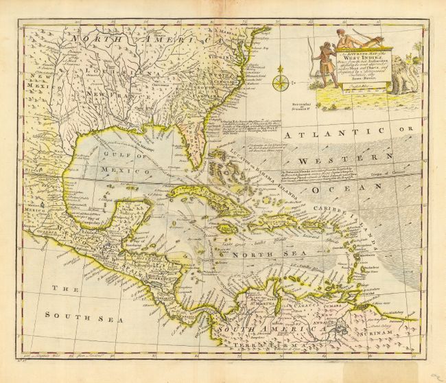
MapMaker: |
Emanuel Bowen
|
|
| |
| |
Subject: |
Gulf of Mexico and Caribbean |
|
| |
Period/Size: |
1747-52 / 13.5" x 16.5" (34.3 x 42.0 cm)
|
|
| |
Color: |
Colored
|
|
| |
Condition: |
(B) Good impression. Toned on centerfold, with some fraying at the top of the map, including a repaired tear just into map. Bottom right margin discolored from old adhesive label, not affecting map. Hinge remnants on verso. (condition help) |
|
| |
Source: |
A Complete Atlas or Distinct View of the Known World |
|
| |
References: |
Sellers & Van Ee #1682. |
|
| |
|
|
| Sales Information |
| |
| |
Price: |
|
|
| |
| |
Offered by: |
Old World Auctions |
|
| |
Catalog: |
Auction No. 118 - Antique Maps, Charts, Atlases & Globes (584) |
|
| |
Lot/Item #: |
446 |
|
| |
| |
Date: |
03/2007
|
|
| |
| |
|