Title:
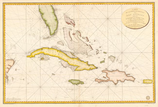
“Carte de la Partie Occidentale des Iles Antilles comprenant St. Domingue, la Jamaique, Cuba et les Iles et Bancs de Bahama…”
Map Maker:
Depot de la Marine
Magnificent, detailed sea chart of the southern ti... (full text available to subscribers)
| Item Detail |
| |
| |
MapMaker: |
Depot de la Marine
|
|
| |
| |
Subject: |
Caribbean |
|
| |
Period/Size: |
1800 / 23.5" x 35.8" (59.7 x 91.0 cm)
|
|
| |
Color: |
Colored
|
|
| |
Condition: |
(A) Printed on fine, sturdy paper. Illegible ownership stamp on the verso. (condition help) |
|
| |
Source: |
|
|
| |
References: |
|
|
| |
|
|
| Sales Information |
| |
| |
Price: |
|
|
| |
| |
Offered by: |
Old World Auctions |
|
| |
Catalog: |
Auction No. 118 - Antique Maps, Charts, Atlases & Globes (584) |
|
| |
Lot/Item #: |
462 |
|
| |
| |
Date: |
03/2007
|
|
| |
| |
|
Antique Maps - Valuation and Pricing, Descriptions, Resources |
|
Home |
Information |
Search |
Register |
Contact Us |
Site Map
Americana Exchange, Inc. © 1999 - 2024 Americana Exchange, Inc.. All rights reserved.
OldMaps.com, the OldMaps.com logo and
AMPR are service marks or registered service marks of Americana Exchange, Inc..
|