Title:
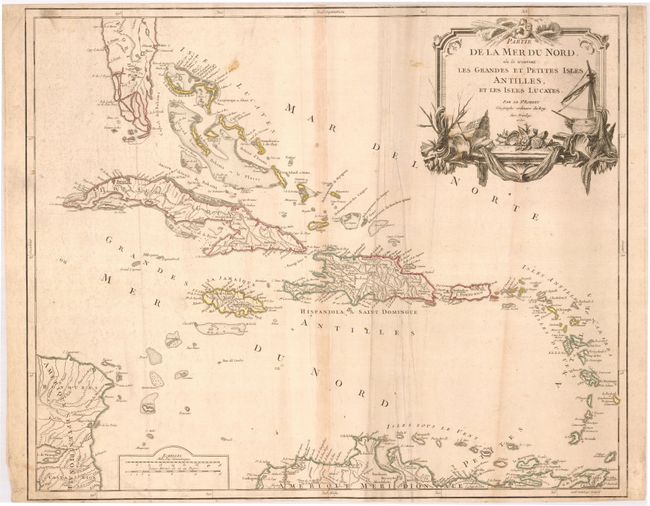
“Partie de la Mer du Nord, ou se trouvent les Grandes et Petites Isles Antilles et Les Isles Lucayes”
Map Maker:
Robert de Vaugondy [Family]
Handsome and detailed map of the Caribbean extendi... (full text available to subscribers)
| Item Detail |
| |
| |
MapMaker: |
Robert de Vaugondy [Family]
|
|
| |
| |
Subject: |
Caribbean |
|
| |
Period/Size: |
1750 / 19.0" x 23.0" (48.3 x 58.5 cm)
|
|
| |
Color: |
Colored
|
|
| |
Condition: |
(B) Nice impression with original outline color. The map is trimmed close to the neatlines at the top and bottom margins. There is some light surface soiling and a few extraneous creases. (condition help) |
|
| |
Source: |
Atlas Universal |
|
| |
References: |
Pedley #476. |
|
| |
|
|
| Sales Information |
| |
| |
Price: |
|
|
| |
| |
Offered by: |
Old World Auctions |
|
| |
Catalog: |
Auction No. 119 - Antique Maps, Charts, Atlases & Globes (585) |
|
| |
Lot/Item #: |
401 |
|
| |
| |
Date: |
05/2007
|
|
| |
| |
|
Antique Maps - Valuation and Pricing, Descriptions, Resources |
|
Home |
Information |
Search |
Register |
Contact Us |
Site Map
Americana Exchange, Inc. © 1999 - 2024 Americana Exchange, Inc.. All rights reserved.
OldMaps.com, the OldMaps.com logo and
AMPR are service marks or registered service marks of Americana Exchange, Inc..
|