Rister or Sign In to see pricing information


Title:

Etats Unis et Grandes Antilles

Map Maker:

Jean Baptiste Marie Chamouin

Etats Unis et Grandes Antilles

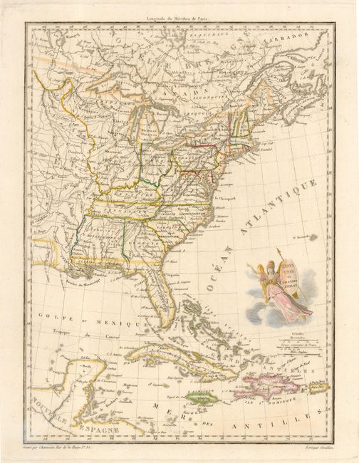
This early nineteenth century map shows the United... (full text available to subscribers)
Item Detail
 
  MapMaker:  

Jean Baptiste Marie Chamouin


  Subject:  United States - Eastern  
  Period/Size:  1810 / 12.0" x 8.8"  (30.5 x 22.4 cm)  
  Color:  Colored  
  Condition:  (A) Damp stain and paper damage in lower blank margin, well away from map. (condition help)  
  Source:  Malte-Brun's Precis de La Geographie Universelle  
  References:   
 
 
Sales Information
 
  Price: 

Please register your email to view records, or sign in with email address to see records


  Offered by:  Old World Auctions  
  Catalog:  Auction No. 118 - Antique Maps, Charts, Atlases & Globes (584)  
  Lot/Item #:  228  
 
  Date:  03/2007  


Antique Maps - Valuation and Pricing, Descriptions, Resources


Home | Information | Search | Register | Contact Us | Site Map

Americana Exchange, Inc. © 1999 - 2024 Americana Exchange, Inc.. All rights reserved. OldMaps.com, the OldMaps.com logo and
AMPR are service marks or registered service marks of Americana Exchange, Inc..